Civil
Why Utility Coordination Influences Permitting, Sequencing, and Project Timelines
-
Sreela Biswas
- January 16, 2026
- 12:18 pm
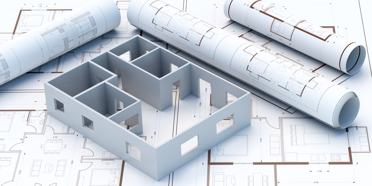
Complete Architectural Construction Document Production In Your Company Standards
Our degreed and trained architectural designers in India work as an extension of your staff on a monthly and hourly subscriptions.
Uppteam’s licensed expert MEP designers, operating remotely, collaborate with US AEC firms to deliver code-aligned MEP design solutions.
Offshore structural design experts deliver top-quality, code-compliant designs and documentation for US projects.
Seasoned civil designers remotely provide unmatched support for advancing site development, grading, and utility plans with sheer accuracy.
Cutting-edge 3D modeling and clash-coordinated documentation empower construction-ready
project delivery.
Dedicated offshore admin teams streamline architect, contractor, and engineering workflows.
Independent and guaranteed error-free model audits, clash detection, and construction
document verification by a specialized team.

U.S.-based local architectural representation, ensuring communication, accountability, and delivery expectations, managed close to the client.
Explore more
Discover our architectural design excellence through a curated selection of projects.
Explore more
Take a look at how Uppteam can elevate your projects with expert engineering solutions.
Explore more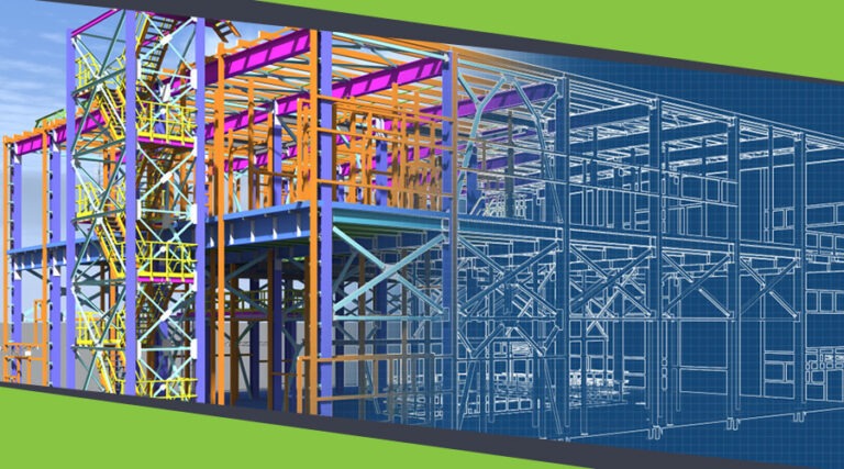
Our Structural Support Services can enhance your structural engineering projects with expert support.
Explore more
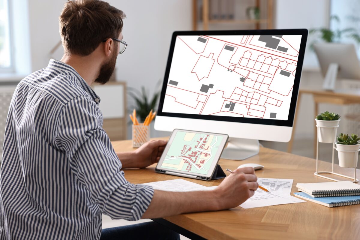
Uppteam delivers precise and reliable surveying and mapping solutions to help you make informed decisions.
Explore more
Whether you're working on residential, commercial, or industrial buildings..
Explore more
Uppteam’s Virtual Admin Support can help you with all your administrative tasks..
Explore more
Our experts work as your 3rd party quality control support partner.
Explore more
Optimal utility coordination is necessary to ensure a project’s success in every respect. In fact, it is a critical backbone of any productive project. It directly impacts several components. Starting with how quickly AEC firms can navigate permitting approvals, construct phased work sequences to maintain realistic project schedules, and coordinate utilities, utility coordination influences all of these.
In the absence of this mainstay, projects tend to suffer extended delays, budget overruns, and regulatory challenges. More importantly, they stretch timelines by weeks or even months in some cases.
AEC professionals are aware that utility relocations carry a high risk of schedule delays. Still, many civil design teams discover utilities when construction is already underway.
Concerns related to surface-level scheduling are just one aspect of the connection between utility coordination and project success. Coordination at the beginning of conceptual design phases brings numerous benefits. When done promptly, it can eliminate expensive redesigns, speed up permitting, and establish orderly construction sequences. Such advantages then enable contractors to efficiently execute these goals.
When utility coordination is an afterthought for AEC firms, the project development timeline is jeopardized, and clients are exposed to unnecessary risks and economic liabilities.
Among the most critical aspects of a construction project is how civil experts handle site planning, grading design, and infrastructure layout. The only component that intrinsically shapes this is proper utility coordination.
Here, civil site plans should accommodate holistic utility information. There should be all the information, from water lines and electrical conduits to sewer systems, gas pipelines, and telecommunications infrastructure. These elements allow design teams to identify conflicts early when changes are still quite simple and cost-effective.
In this context, the role of the Subsurface Utility Engineering method is massive. Adhering to ASCE 38-22 standards, SUE investigations offer accurate underground utility information that fosters civil design choices. These assessments convert ambiguous utility assumptions into documented, location-confirmed data. Then, civil professionals are responsible for incorporating this data into grading plans, drainage mechanisms, and roadway geometry. This ensures the prevention of conflicts before they turn into permitting bottlenecks or construction disruptions.
Nothing short of robust civil drawings should be submitted to permitting authorities. These drawings must include utility locations, right-of-way considerations, easements, and conflict resolution strategies.
It is crucial for design teams to identify and coordinate utilities at the outset of the development process. Only then can they submit permit applications with comprehensive, conflict-free documentation. This guarantees more rapid approval from the reviewers. Most transportation departments inform utility companies at the 30% design stage. As a result, designers become capable of avoiding some utility relocations and eliminating complications entirely.
Keep in mind that the permitting timeline relies significantly on the completeness of utility coordination. Remember that permitting delays can increase when design teams hand in incomplete utility information or skip some coordination requirements.
Therefore, to ensure faster permitting approvals:
Note that construction sequencing is fully dependent on utility relocation timeframes. These schedules need months of advance planning and design work.
It is the responsibility of civil professionals to sequence site work so that utilities can be relocated before contractors can start initial construction in those areas. Installation of water and sewer lines should be done before road paving. This calls for coordinated sequencing of installation workflows across several utility providers and construction teams.
The majority of utility firms imply they need 1-3 months’ prior notice about construction schedules to mobilize staff, attain permits for relocations, and conclude work within the project window. When contractors wait until pre-construction meetings to contact utilities, they find out that relocation schedules no longer match their construction timelines. As a result, delays or out-of-sequence work become inevitable, amplifying both costs and safety risks.
Evidence shows that coordinated utility plans can effectively get rid of costly sequence disruptions. While civil design teams work on establishing clear utility relocation timelines during the design stage, contractors focus on sequencing primary work around familiar utility mobilization windows.
Temporary utility service provisions are crucial, as they maintain operations at the time of relocations. What follows is the elimination of business interruptions and the permanent realignment of infrastructure. This coordinated method maximizes crew productivity throughout all project phases, eliminating the need to wait for utility work to finish.
The following initiatives need to be taken:
It is important to understand that conflicts traced during construction lead to instant work stoppages, redesigns, and re-permitting. All these additional tasks further stretch the overall timeline. While construction teams cease all work in conflict zones, design experts develop substitutes, attain regulatory sanctions, and coordinate implementation. Such reactive initiatives turn minor utility conflicts into significant schedule events that impact budgets, staff productivity, and project completion dates.
On the other hand, project documentation discloses the magnitude of unaddressed utility conflicts. It is worth noting that without advance coordination, construction projects are often subject to schedule pushbacks that can range from weeks to months. A documented Federal Transit Administration project faced 460 days of delay because utility relocation work was designed, sanctioned, and completed late in project execution. FTA reports confirm that utility relocation is the primary reason for transportation construction delays.
So, what is the solution? Here, proactive utility coordination is the savior, converting this risk into workable planning. Civil professionals operating with Subsurface Utility Engineering experts can easily track down all utilities impacting the project at the outset of the early design stage. Basically, they evaluate feasible conflicts in a systematic manner. Then they coordinate them with utility firms on resolution tactics and, finally, document all discoveries in utility conflict matrices. This holistic approach facilitates project schedules by incorporating pragmatic utility relocation timelines. Ultimately, this technique avoids reactive delays.
Contemporary civil design utilizes integrated planning tools to aid utility coordination. These tools help strengthen communication across design verticals. The phases of construction documentation initiate robust coordination, with Good For Construction packages backing seamless permitting and field implementation. BIM fosters civil experts to visually represent utility conflicts in three dimensions. This makes the identification of spatial interferences easy, which 2D drawings often miss.
Then, there are digital permitting platforms. They help expedite municipal sanctions by removing paper-based inefficiencies. Instead, electronic permit sets come into the picture, reducing documentation deferrals. AI-based compliance checks also prove to be valuable, as they automatically validate that drawings are compatible with regional building codes before final submission. In some municipalities, you can now upload BIM models directly to check whether they comply with local codes. This enables building authorities to provide feedback or approval within just a few hours.
Cutting-edge site analysis also plays an important role in this context. Modern civil designers take advantage of GIS mapping. It integrates utility records, environmental limitations, and easement information into federated digital environments. Evidently, coordinated site models lay the groundwork for permit applications, continuous project communication, and contractor coordination meetings. These tools remodel utility coordination from inconsistent communications into unified planning processes that optimize each project stage.
At its core, utility coordination determines construction sequencing effectiveness, permitting timeframes, and overall project schedule maintenance throughout a project. This necessitates that AEC firms invest in early coordination processes, including tracking utilities during conceptual design, creating clear coordination schedules, and documenting rigorous conflict-resolution strategies before construction commences.
So, if you are struggling with similar challenges, reach out to Uppteam right now. We are your reliable partner, delivering unmatched, robust civil design support services. Our civil design team specializes in preparing coordinated civil drawings that convert surveys, utility information, and zoning directives into clear construction documents consistent with local review expectations.

Often, civil design is perceived as just a checklist item in the AEC spectrum. This means that many AEC businesses still view civil design as merely an administrative challenge to satisfy municipal regulators. Nevertheless, this compliance-centric mindset neglects a vital reality about contemporary construction projects.
In fact, civil engineering is actually an AEC firm’s first line of defense to counter long-term liability and economic loss. Essentially, it indicates the site’s financial viability before the first foundation work commences.
By changing the mindset from mere permitting to aggressive risk management, AEC companies can safeguard their clients from millions of unexpected expenses. This preemptive approach converts a mandatory cost into a crucial asset for a project’s stability.
This blog article will walk you through the reasons for considering modern civil design as a risk management tool rather than just a compliance mandate.
Do you know where the most detrimental economic losses arise in a construction project? Well, the answer is from risks that are technically detectable but are actually ignored.
Remember that a holistic civil design procedure starts with proactive due diligence beyond basic zoning authentications. We seldom see developers focus solely on perfecting sites that later require millions in remedial foundation work. The simple reason behind this is that preliminary reviews are trivial.
Therefore, robust feasibility studies are the best approach to identifying important limitations, such as unstable soil strata or high water tables, early in the project’s stages.
Such a degree of scrutiny facilitates AEC firms in making well-versed decisions with confidence. In return, this helps prevent firms from inheriting liability for recognizable field conditions. Efficient due diligence also provides guidance on the budget for site preparation and infrastructure. As a result, businesses can avoid the embarrassment of having to request additional funds from clients due to unforeseen circumstances.
Currently, 3D modeling technologies enable firms to visualize terrain interactions with top-notch accuracy. This early-stage visualization minimizes design errors and improves communication with stakeholders. Using these tools during feasibility analysis transforms vague concepts into data-centric strategies. So, it is not just about drawing lines; it is more about anticipating the site’s future.
In the built environment, water is the most litigious element. Simply put, if a project causes flooding downstream, the legislative consequences can last for decades.
These days, municipalities across the country are becoming more and more strict. Yet, meeting the code is merely the minimum standard. This is precisely where smart civil design can make a real difference. Rather than depending completely on minimum code requirements, it provides protection against extreme weather events that outpace past data.
There have been cases where developers faced lawsuits many years after selling a property because the stormwater system failed to handle runoff during an extreme weather event. This indicates that a design that somehow meets the code seldom fails when real-life climate conditions change unexpectedly.
In this provision, AEC firms should consider the wider hydrological effects of the development on the surrounding ecosystem to avert negligence claims. Unable to handle stormwater can result in severe property damage, leading to litigation that even settlement negotiations may not easily resolve.
In such a scenario, robust detection strategies should be in place to safeguard the client from future insurance claims and to demonstrate a commitment to sustainable development. This forward-thinking approach lays a flawless path for future project approvals in the same jurisdiction, as regulators would have greater trust in your firm’s engineering rigor.
Moving dirt is among the most variable and risky line items in any construction project budget. Poor grading plans that compel contractors to either import or export large amounts of soil increase fuel costs and project timelines. A tactical civil design can balance cut and fill volumes to keep soil on the field whenever possible. This directly influences the bottom line. Moreover, it calls for an accurate grasp of the prevailing topography and the suggested vertical alignment to curtail waste.
Thus, the following initiatives can be taken to manage construction costs effectively:
Among the most prominent “silent killers” of construction timelines are underground utility conflicts. As a matter of fact, they often remain unidentified until mobilization.
Evidently, conventional 2D plans frequently fall short of showing where storm lines are interacting with prevailing gas mains or electrical conduits. These clashes are generally spotted only when an excavator hits an obstruction. This contributes to work stoppages that cost thousands of dollars every day. Modern-day 3D civil design comes to the rescue by flagging such clashes well before construction work starts. Subsequently, engineers get the flexibility to route utilities around obstacles with top-level precision.
One can think of this virtual construction phase as a digital rehearsal that ensures gravity-fed systems have the required slope without disrupting other infrastructure. Truly, we can now visualize complex intersections that were previously impossible to validate on paper. Accordingly, firms get to experience a dramatic reduction in rework-related risks.
By fixing these issues digitally, firms can shield the project schedule from avoidable delays that disappoint clients. It further harnesses improved collaboration among civil, structural, and MEP teams. In the end, this guarantees that everyone operates from the same source of information.
In most cases, the permitting stage is the biggest barrier in the U.S. construction pipeline. More often, regulatory reviewers are overworked and susceptible to rejecting plans for minor code noncompliance or incomplete data. In reality, a permit delay pushes a project’s start date into a different month, which then escalates material prices and overall project expenditures.
So, it’s understandable that civil design is the basis of risk management for any construction project. It impacts legal liability, economic feasibility, and delivery speed. The time has come for AEC firms in the U.S. to refrain from viewing it as a commodity and to start treating it as a high-stakes strategy.
Evidently, a proactive civil design approach can save money, time, and reputation in the long term. It also makes sure that the site transforms from a variable risk into a manageable asset. Undoubtedly, the current market rewards organizations that deliver predictability in an unpredictable world, and rigorous civil design and engineering are the keys to that stability.
This is the point at which Uppteam becomes your most suitable tactical partner in risk mitigation. Specializing in robust civil design services, we go far beyond just compliance.
Team up with Uppteam to transform your civil design process into a competitive advantage.
In the United States, urban centers are going through a significant transformation. Interestingly, industrial zones and historic districts are turning into dense mixed-use communities. Such revitalization fosters considerable economic advancement in our cities. Nevertheless, it also comes with immense pressure on existing subsurface utilities.
Perhaps the most vital stress point seldom revolves around managing stormwater effectively. Old systems just cannot tackle contemporary density and climate conditions. That is why AEC businesses should now favor resilient civil drainage design in urban redevelopment.
In this blog, we will walk you through the particular hurdles that one such project faces today, while also examining pragmatic design solutions for these complex sites.
Honestly, the condition of American water infrastructure demonstrates a sobering reality for developers. AEC firms are likely inheriting systems that have already surpassed their intended lifespan. Recently, the American Society of Civil Engineers released its 2025 infrastructure report card. Unfortunately, ASCE has awarded America’s stormwater infrastructure a disappointing “D” grade. This resonates with underinvestment and delayed maintenance. What it also reveals is that municipal systems across the country lack the ideal capacity for new high-density inputs.
From a strict AEC perspective, linking a contemporary high-rise to a century-old sewer is not at all an easy endeavor. It calls for a very careful planning approach. AEC firms encounter the risk of overloading the public drainage main during peak flow events. This liability concerns several U.S.-based engineering principals. Evidently, the 2022 Clean Watershed Needs Survey by the EPA exemplifies this financial gap.
The 20-year requirement for large stormwater systems has reached $115.3 billion. It showcases a massive increase from past estimates. So, the civil designs should take into account such downstream constraints. AEC firms cannot simply assume that the public right-of-way can get along with unmitigated flows. Thus, on-site detention turns out to be a non-negotiable specification for the majority of urban projects.
It is imperative to realize that redevelopment projects often elevate the density of a site’s footprint. AEC firms substitute permeable soil with asphalt, concrete, and rooftops. This change basically alters the regional water balance. Research indicates that impervious pavement augments surface runoff by around 43%. This boost in volume contributes to instant drainage challenges for the site engineers. As a result, the land’s natural infiltration capacity is eliminated. Rather, the water rapidly flows to the catch basins.
If you are still unaware of this phenomenon, know that it is recognized as “hidden urbanization.” It results in higher peak flow rates whenever there is a storm event. So, the AEC teams should focus on designing systems that mirror pre-development hydrology. The inability to do so further increases the risks of urban flooding.
Multiple studies have shown that when impervious surfaces go beyond the 10% mark, the frequency of waterlogging amplifies. This reality calls for a transformation in the standard design approach. AEC firms can no longer depend on quick conveyance. The emphasis must move toward volume curtailment and retention. Civil engineers need to measure these loads with top-level accuracy. Keep in mind that every single square foot of hardscape adds to the hydraulic load.
It is well known that U.S.-based AEC businesses operate under stringent regulatory frameworks. Conforming to the established protocols is not just about transferring water off-site anymore. Firms need to comply with extensive federal, state, and regional standards. The EPA guides many of these requirements by means of the NPDES program. Besides, state-level evaluation criteria are becoming even stricter. Navigating this scenario requires niche knowledge and a high level of attention to detail.
The civil design should be in line with local MS4 permit specifications. These permits make it compulsory for new developments to follow particular pollutant reduction targets. AEC firms should ensure that their projects’ sites do not degrade surrounding waterbodies.
This federal initiative governs point sources of pollution. Those construction sites that disturb over one acre must have coverage. Bear in mind that the Stormwater Pollution Prevention Plan is a key deliverable in this provision.
These days, many jurisdictions have strict pre-development discharge rates. AEC firms need to satisfy the demands of peak flows for diverse stormwater frequencies. This seldom enforces the inclusion of large underground storage vaults.
Particular water bodies have specific limits on pollutants such as sediment. So, civil design should proactively address runoff to eliminate these contaminants. This adds a new layer of water quality design to quantity control.
AEC firms can get hold of these runoff issues through sustainable design strategies. In the U.S., Sustainable Urban Drainage Systems have gained substantial traction in the last couple of years. These systems are capable of managing water naturally close to their source. They provide a comprehensive alternative to conventional “gray” infrastructure. The aim is to slow the speed of flow and promote infiltration. Some of the most renowned and effective techniques consist of permeable pavements, bioretention cells, and green roofs.
The incorporation of these properties mandates close coordination between civil and landscape teams. For example, seals can be substituted with conventional pipes in some parking zones. This shift curtails infrastructure expenses and elevates water quality. Research also suggests that optimizing impervious surface layouts can significantly reduce runoff impacts. AEC firms must view these features as dual-purpose assets.
On the other hand, a rain garden can manage stormwater while enhancing aesthetics. Green roofs facilitate reductions in building cooling loads and the retention of rainwater. These design fixes also support meeting the rigid regulatory constraints mentioned earlier. They depict a dedication to environmental stewardship. Note that clients progressively value these authorizations for their properties.
Modern drainage issues need modern technological remedies. AEC firms just cannot depend on rational method calculations for complex sites. Cutting-edge hydraulic modeling software has now become the industry standard. These advanced tools enable the simulation of realistic storm events. AEC firms can visualize how water flows across the proposed site. Evidently, this digital approach mitigates expensive errors at the time of construction.
Software facilitates firms in modeling storms of different durations and intensities, simulating vigorous rainfall-runoff routing. One can see exactly when and where flooding may happen, detecting particular problem areas in real-time. This assists in sizing detention systems more precisely to make sure that even a century-old hydraulic grade line stays below critical elevations.
Urban sites are already densely populated with prevailing underground infrastructure. Here, 3D modeling ensures that conflicts between gas and electric lines are avoided by overlaying utility information onto the design. This coordination is pivotal to feasible civil drainage design, minimizing the likelihood of costly redesigns and utility strikes.
Modeling also guarantees that firms do not oversize or undersize their networks by automatically computing hydraulic grade lines. The focus should be on installing exactly what is required to save clients money because small-scale physical modeling provides cost-saving alternatives.
One can produce heat maps highlighting water depth on pavement with the help of a 2D hydraulic analysis. This confirms that emergency routes are always passable during storms by precisely demonstrating the lateral extent of inundation. It offers visual evidence of design safety to municipal reviewers to ensure flawless accessibility of critical infrastructure.
So, urban redevelopment calls for a superior standard of civil engineering. AEC firms are now facing aging public infrastructure and stringent environmental guidelines. This change in the direction of impervious surfaces complicates site hydrology even more. However, the industry has the ideal tools to deal with these challenges. Through the adoption of green infrastructure and innovative modeling, an AEC firm can guarantee resilience. These strategies also help safeguard the clients’ investments and the urban environment.
Uppteam understands the complications of U.S.-based urban civil engineering projects. Our expert team specializes in providing accurate civil design support. Partnering with Uppteam will allow your core team to focus on client relationships, while we handle the heavy lifting of drainage calculations, grading, and stormwater modeling. Let us assist in your upcoming urban redevelopment project with unmatched precision.
Rising urban temperatures are a global phenomenon. In fact, they pose significant challenges for modern American cities. There are specific reasons why urban temperatures are increasing each year. First of all, dense infrastructure absorbs substantial solar radiation during the daytime. Besides, asphalt and concrete surfaces hold intense heat energy nonstop. Consequently, this urban heat island effect significantly increases cooling requirements.
Generally, a building’s energy usage increases significantly in hot climates. Accordingly, public health hazards rise during any extreme heat events. This necessitates that structural and civil professionals fundamentally reimagine how cities operate thermally.
Among the proven methods for notably reducing urban temperatures are choosing materials and designing strategically. Currently, most of the U.S.-based AEC firms know that heat mitigation boosts their competitiveness. On top of that, the latest building codes mandate thermal performance documentation for new constructions.
In a typical construction setting, choosing the right materials is crucial. When it comes to urban heat resilience, this factor becomes even more significant. This factor determines how buildings fundamentally interact with solar radiation. It is common knowledge that dark surfaces extensively absorb solar energy throughout the daylight hours.
Surfaces made from traditional concrete and asphalt regularly reach temperatures going beyond 150°F. Next, these hot surfaces radiate the heat they stored during the evening hours. Surrounding structures face increased cooling demands from this effect. On the contrary, cool materials reverse this dynamic entirely.
In such scenarios, reflective roofing materials are highly effective. They can reach solar reflectance indices over 78 for low-slope applications. According to ASHRAE 90.1-2022, a commercial roof must have a minimum solar reflectance of 0.70. These specifications cut down roof surface temperatures by 20 to 30°F as opposed to the traditional options. Reduced surface temperatures curtail radiation to the nearby urban air by a vast amount.
When it comes to reducing cooling energy demand, the best option is double glazing. In comparison with single glazing, this approach can reduce cooling energy requirements by around 10.5%. New-age glazing contains low-emissivity coatings for improved performance. These coatings simultaneously help to minimize summer solar heat gain.
Wall materials need equal-level attention to roofing for thermal management. Thermal mass materials, such as concrete, gradually absorb additional daytime heat. Gathered heat releases steadily during the evening hours. This gap decreases peak cooling requirements during the hottest periods.
Building orientation demonstrates solar exposure throughout seasonal cycles. During summer months, south-facing facades receive concentrated solar radiation. The east and west facades receive intense morning or afternoon sun. This is precisely where strategic orientation comes into play. It assists in reducing cooling requirements by up to 50%. That is why engineering teams must assess site limitations thoughtfully during planning.
If a building is situated in a hot climate, it should proactively aim to minimize south- and west-facing exposure. In such a context, architectural form becomes the first line of defense against solar heat gain. Here, compact rectangular plans ensure that there is a reduction in surface area exposed to direct sunlight. Additionally, courtyard designs help to naturally moderate interior temperatures.
There is another key aspect to watch out for. Window positioning should resonate with solar paths across all seasons. Remember that small windows on hot façades can lower solar heat gain.
Passive design techniques work without mechanical intervention during ideal conditions. Here, cross-ventilation supports the removal of stored heat during cooler evening hours with sheer precision. When operable windows are placed strategically, they can facilitate natural airflow for cooling. Building geometry comes into the picture by channeling existing breezes through interior spaces. Thereupon, occupants encounter better thermal comfort with reduced consumption.
Dynamic shading systems can automatically adjust to the sun’s position. Plus, motorized louvers aid in accurately tracking sun paths, leveraging innovative sensor technologies. Real-world observation indicates that building management systems can seamlessly integrate shading with HVAC operations. Buildings with advanced shading can attain energy savings of around 30-40%. Subsequently, structural engineers need to meticulously accommodate mechanical shading hardware loads.
Several studies have shown that green infrastructure is an efficient cooling strategy to mitigate the urban heat island effect. Green infrastructure ensures continuous urban cooling through several concurrent mechanisms.
Trees provide shading for building surfaces and significantly reduce ambient air temperatures. By releasing moisture into the air via evapotranspiration processes, vegetation keeps surrounding areas cooler than the rest of the zones. Green roofs support insulating building tops while maintaining active plant communities. Rooftop vegetation is also very effective in reducing cooling energy demand.
Permeable pavements are becoming increasingly common. They have surfaced as a strategic approach, offering a competitive advantage. Practical observations and studies verify that permeable concrete pavements bring surface temperatures down by 25 to 30% in comparison with traditional materials. Water drains through linked pores within the pavement structure. Evaporation from stored water greatly reduces the temperatures in the surrounding areas.
Heat mitigation strategies are now mandatory under applicable U.S. building codes. For commercial urban infrastructures, ASHRAE Standard 90.1-2022 sets the energy performance baselines. As per the International Energy Conservation Code, cool roof provisions are compulsory in climate zones 1 to 3. State-level energy norms offer extra thermal performance choices.
It is also essential to note that LEED certification systems award points for heat island eradication initiatives. Sustainable sites credits support projects incorporating several cooling tactics. Building design projects can earn 2 points for reducing the heat island effect, while prevailing buildings that uphold LEED operations earn 1 point. Recognizing these aspects, AEC firms should employ cooling strategies in a systematic manner.
Thermal performance modeling signifies adherence to changing standards in detail. Energy simulation applications come with the ability to forecast yearly cooling demands under numerous scenarios. Engineers need to test alternative material choices and mechanical systems holistically. Modeling helps to spot optimal design configurations before actual construction work.
So, one thing is sure. All of the AEC verticals should work in a coordinated manner to ensure successful urban heat mitigation. While architectural teams should focus on developing building form and orientation during the early stages, structural experts need to make sure systems support innovative materials and green infrastructure. At the same time, civil professionals should emphasize designing permeable site layouts with intrinsic stormwater management capabilities.
The role of an MEP engineer in this provision is to optimize HVAC systems to run with passive design. This collaborative approach boosts thermal performance comprehensively. Undoubtedly, AEC businesses should utilize heat resilience strategies to ensure a competitive edge in the current industry landscape.
If your AEC firm is seeking support to guarantee urban heat resilience in upcoming projects, there is no better choice than Uppteam. Our structural design and civil design services deliver robust solutions to ensure optimal urban heat resilience.
So, wait no more and make us your structural and civil design partner to unlock the full potential of successful urban heat-resilient projects.

Discovering even a single conflict between structural beams and utility lines can result in significant additional expenditures for rework alone. Civil and structural conflicts are hidden project killers. They can derail schedules, increase budgets, and strain client relationships. Contemporary AEC firms face immense pressure to deliver complex projects quickly while upholding stringent quality standards and adhering to projected budgets.
It is essential to acknowledge that construction disputes waste both valuable time and resources. They also cause considerable delays to project completion. Recent studies reveal that rework generally takes up to 5-15% of the overall project expenses. Here, structural and civil coordination challenges account for a substantial portion of these costly delays. Intelligent firms are aware that investing in early conflict detection supports quantifiable competitive advantages. They extend well beyond instant cost savings.
This blog highlights how civil-structural clashes can emerge, negatively impacting projects and how these clashes can be detected early.
In construction projects, clashes between civil and structural elements are a common occurrence. They arise when building systems reside in the same space or violate design attributes. These can compromise functionality and safety.
Common conflicts contain utility lines intersecting structural foundations, grading plans contradicting building elevations, and MEP systems disrupting structural load paths. These spatial clashes contribute to installation complications. The result of this is expensive on-site modifications and compromised system performance.
Unaddressed conflicts between structural foundations and civil site work signify specifically high-cost issues. When site grading contradicts building elevations or utility routing impedes structural components, projects require thorough redesign work. This delays overall construction timelines. Modifying the foundation becomes exponentially more costly after concrete has been placed. As a result, early clash detection becomes more critical to stay within budget.
Note that behavioral aspects compound technical clashes when stakeholders have unrealistic expectations or fail to communicate design requirements effectively. Weak coordination between disciplines contributes to information gaps. The biggest drawback of this is that conflicts remain unrecognized until actual construction begins. Such communication problems seldom turn into contractual disputes that further delay project advancement and amplify legal expenses.
Concerning conflict detection, the role of cutting-edge Building Information Modeling is unmatched. This technology revolutionizes conventional clash detection through the creation of innovative 3D environments. Here, civil and structural systems interact virtually prior to actual construction.
The most up-to-date BIM platforms automatically spot spatial clashes between disciplines. The credit for this goes to sophisticated clash detection algorithms. They come with the capability of scanning models nonstop for overlaps and clearance violations.
Cloud-centric BIM coordination platforms facilitate distributed teams to collaborate effortlessly on complex building projects. Consequently, stakeholders can access existing model data concurrently, removing version control challenges that create communication gaps between structural and civil disciplines. This means there is no further need for frequent coordination meetings and an improvement in decision-making quality throughout the design phases.
There are also innovative clash detection applications. They can assess spatial relationships with precision tolerances that consider installation clearances, code compliance specifications, and maintenance access. Moreover, automated testing conventions spot conflicts instantly when design alterations happen. This ensures coordination precision across the entire project evolution. Integration attributes should involve:
Remember that structured workflows that easily integrate with design development procedures across disciplines are pivotal to successful clash detection. Thus, project teams need to have clear protocols for submitting models, reviewing conflicts, and tracking resolutions that uphold coordination quality throughout. Early implementation ensures optimal value by resolving conflicts when design flexibility is the highest and modification expenses are minimal.
Standardizing the modeling requirements is the first step toward effective coordination workflows. They guarantee unparalleled quality across every discipline. Teams should specify Level of Development parameters, geometric precision standards, and information requirements that aid reliable clash detection between civil and structural components. Standardization removes any false positives and makes sure that legitimate conflicts get the needed attention from qualified professionals.
It’s critical for resolution protocols to assign specific responsibilities for investigating and correcting conflicts between civil and structural verticals. Teams need decision-making hierarchies to avoid any coordination delays when clashes impact multiple project stages or regulatory requirements. Here, documentation processes should be capable of tracking resolution progress and verifying the quality of implementation. The implementation strategies should entail:
Undoubtedly, preemptive clash detection generates tangible returns through reduced rework, expedited timelines, and improved construction quality across civil and structural elements.
It is essential to understand that the initial expenses of incorporating BIM are typically recovered during the first significant project. This is the result of reduced change orders and less time spent on field coordination. Over time, benefits accrue as teams enhance their modeling competency and streamline workflows for future projects.
Additionally, fewer field changes, less material waste, and better allocation of labor in civil and structural operations contribute to direct cost savings. With detailed clash detection, projects experience minimal change orders, and construction work accelerates. Accordingly, field workers can install coordinated systems without the need for expensive relocations. Effective and well-coordinated installations further reduce long-term operational costs, often offsetting the investment in innovative coordination services that can eliminate high-cost conflicts.
With time, civil and structural projects are becoming increasingly complex. What they need is sophisticated coordination approaches. They help tackle system interdependencies and construction sequencing requirements.
It is worth noting that multidisciplinary coordination is not just about addressing spatial conflicts. Teams should handle installation logistics, inspections, and regulatory compliance. Through the use of innovative planning techniques, it can be ensured that these factors are considered early to avoid any surprises during construction.
Besides, regarding performance-focused coordination, installation is not the sole important thing. It must also ideally handle operational efficacy, access to maintenance, and any further potential modifications. By planning these attributes early, structural and civil teams can identify and address relevant clashes well in advance of actual construction. The final outcome of this would be the eradication of expensive delays and an enduring guarantee of facility performance.
Conflicts related to civil and structural components may seem small in drawings. However, their consequences in the field are anything but minor. Weak coordination between these domains leads to rework, delays, budget overruns, and a reputational impact. Therefore, proactive detection using federated modeling, clash detection tools, and disciplined operations eliminates such challenges before they arise on site.
If your U.S.-based AEC firm wants to avoid expensive clashes and deliver flawless coordination projects, Uppteam provides a comprehensive suite of civil design, structural modeling, BIM coordination, and QA/QC services. Let us collaborate with you to embed early clash detection into your construction operations and future-proof project delivery.

Could a laser scan revolutionize how an AEC firm plans rail corridors or highways? Standing in 2025, the answer is yes. Here, another important question pops up: Is LiDAR the technology that has been radically changing how civil engineers approach transportation-related infrastructure planning?
A closer look at the AEC sector in the USA reveals that many businesses are nurturing and exploiting LiDAR. This is because of the speed, accuracy, and capability it brings to convert complex terrain into workable 3D data. Furthermore, if LiDAR is included in BIM workflows, it makes 3D construction documentation smarter and more efficient than ever before.
This blog will spotlight the reasons behind civil engineers in the US now extensively preferring LiDAR for transportation planning.
Light Detection and Ranging, in short LiDAR, basically utilizes laser pulses to create dense yet precise 3D point clouds of terrain and assets. The basic notion behind LiDAR revolves around using laser beams to measure distance, which first came up during the 1960s. NASA and the US military are among the pioneering institutions that still use advanced levels of LiDAR.
Depending on the application, these systems can be vehicle-mounted, aerial, or tripod-based. This facilitates the development of road surfaces, Digital Elevation Models, and construction geometry with centimeter-level precision. LiDAR can do all of these even under vegetation cover or rail embankments.
In the civil engineering spectrum, LiDAR is a relatively new technology. Undoubtedly, recent developments and the commercialization of this technology have made it an indispensable asset in civil engineering. For civil engineers, there are several advantages to using this technology, such as:
These particular benefits make LiDAR an invaluable tool in transportation infrastructure projects.
Due to the rising demand for delivering resilient construction projects within tight deadlines, modern-day civil engineers are under immense pressure. Conventional surveying approaches like GPS and total stations need abundant man-hours. They often pose safety challenges when crews work near traffic.
In such instances, LiDAR becomes particularly important. By using quick laser pulses to capture millions of points, this technology aids in the creation of precise, high-resolution maps within just a few hours.
Leveraging LiDAR in transportation projects facilitates:
Besides, LiDAR sensors placed on drones or vehicles can be used to scan and map road reconstruction areas, completing the job in only a few weeks.
These days, road-widening projects are widespread. Time carries considerable weight for civil engineers working on such projects. The Mississippi Department of Transportation has reported that LiDAR surveys on important routes have allowed them to measure shoulder distances, land widths, and the surrounding terrain without disrupting traffic. These effective digital scans mean improved safety, less downtime, and a smoother workflow for contractors and agencies.
LiDAR aids road-widening projects by:
Therefore, it is essential to understand that the gathered data facilitates error-free cut-and-fill calculations and earthwork estimation. Moreover, LiDAR also supports contractors in avoiding additional excavation and minimizing waste. This assists in preserving budgets and staying within the specified timeline.
A major freight railroad network operating in the western US and Canada, BNSF, is extensively exploiting LiDAR. This organization uses the technology for high-capacity rail upgrades and routine upkeep. Mobile mapping systems enable the quick scanning of bridges, tracks, and signaling assets with top-notch accuracy.
The main advantages that projects related to railway upgrades experience involve:
LiDAR has proven to be highly reliable in strict settings, such as rail yards, tunnels, and high-traffic corridors. It further supports “digital twins” for the complete right-of-way. This aids civil engineers in better visualizing each asset, spotting encroachments, and handling clearance profiles with unparalleled detail.
Dealing with drainage is essential for transportation resilience. Inefficient drainage design can drastically damage highways and rail corridors. That is why LiDAR data is currently critical to curating thorough digital elevation models that are at the heart of contemporary drainage analysis and hydraulic modeling.
It needs to be comprehended that conventional DEMs seldom miss small but crucial features because of lower spatial fidelity. On the contrary, LiDAR-driven models spot bottlenecks without any errors that can cause expensive repairs if missed during planning.
Contemporary construction projects, especially the infrastructural ones, necessitate digital records that last beyond completion. Combining LiDAR data into BIM workflows signifies a new optimal standard in 3D documentation.
Key gains from the BIM-LiDAR tie-in include:
So, it is clear that the integration of LiDAR with BIM is essential. This collaboration makes it straightforward for multiple stakeholders to visualize existing site conditions, track progress, and prepare for future upgrades in a shared digital environment.
Although LiDAR comes with several clear benefits, it is crucial that AEC firms maintain best practices to exploit the technology for optimal outcomes.
First of all, it is imperative to train in data collection and appropriate post-processing for the best results. AEC firms should also authenticate raw LiDAR output with on-site spot checks. This authentication task is even more helpful for critical areas. Besides, compatibility between LiDAR outputs and ideal BIM software must be ensured. Lastly, addressing data storage and management challenges should be prioritized because file sizes can be large.
Staying updated on guidelines and utilizing the most up-to-date processing algorithms will further assist civil engineers in getting the most out of their LiDAR investments.
It is evident that adopting LiDAR is not just an innovation anymore. It has now become the norm. Using the LiDAR report enables the civil engineering team to:
By capitalizing on these benefits, US-based AEC companies can remain competitive and win bigger and more complex bids confidently.
So, to ensure sustained success in the current transportation-related infrastructure space, every AEC business must integrate LiDAR into civil engineering and infrastructure planning. The ideal outcomes for railway improvement, road widening, and drainage rely on trustworthy 3D data and seamless BIM integration.
If you need an expert who understands how to include advanced LiDAR and BIM solutions in work, there is no better option than Uppteam. Our dedicated expertise can ensure your business is always ahead of the competition. So, connect with our team now for smart support on LiDAR in transportation planning. With Uppteam, take your next assured step toward future-ready and resilient infrastructure.

Three months ago, a general contractor called our office in a panic. His crew was supposed to start foundation work on a retail development, but they’d hit a problem. Big problem. The storm sewer main that was supposed to be six feet south of the building footprint? It was actually running right underneath it.
Nobody caught this during design. The city’s utility records were wrong; they’d been mistaken for about fifteen years, ever since a previous project relocated the line but never updated the drawings. The surveyor missed it during the site survey because, well, it’s underground and the locating service doesn’t always get everything.
So now what? Redesign the entire building layout? Move the storm sewer? Either option meant months of delays and a lot of expensive change orders. The developer was not happy.
This stuff happens more than you’d think. Sites look simple from the outside, but underneath, there’s usually a maze of utilities, weird soil conditions, and drainage issues that somebody forgot to mention. Getting a site actually ready for construction—really ready, not just “looks ready on paper”—takes more work than most people realize.
Everything moves faster now than it used to. Developers want shorter approval timelines. Contractors are booking projects back-to-back with almost no buffer time. Financing costs more, so carrying expenses during construction eat into profits faster.
This creates a problem, though. When you’re rushing to get started, it’s tempting to skip some of the detailed site investigation work. Or to make assumptions about utility locations. Or to figure out that grading issues can be worked out in the field.
Except they can’t, usually. Field fixes cost way more than getting it right during design. And they take longer than you’d expect because everything has to be re-approved, sometimes by multiple agencies.
We worked on a project last year where the civil engineer made a perfectly reasonable assumption about soil conditions based on a geotechnical report from an adjacent property. Sensible, but wrong. The actual soil on site needed different compaction methods and different drainage details. That assumption cost the project approximately six weeks and around $180,000 in additional site work.
The crazy part is that a couple of extra soil borings during the initial investigation would have cost maybe $3,000 and prevented the whole mess.
People think grading is simple—you move some dirt, make things level, and that’s it. However, there’s actually a lot going on.
Water is probably the biggest issue. Rain falls on your site whether you want it to or not. It has to go somewhere. If you don’t control where it goes, it’ll find its own path, and you probably won’t like where that ends up.
Basic drainage isn’t that complicated, but modern stormwater regulations make it more challenging. Most cities now have requirements for detention, treatment, peak flow control, and a bunch of other stuff that didn’t exist twenty years ago. Some places require you to match pre-development runoff patterns exactly. Others want you to improve on them.
Then there’s the dirt itself. Moving soil around costs money—a lot of money if you have to haul it a long distance. The best grading plans try to balance cut and fill so you’re not trucking loads of dirt back and forth to disposal sites. This is harder than it sounds, especially on sloped sites or when you have underground parking to deal with.
And everything has to meet accessibility codes, fire department requirements, and whatever local standards apply. Sometimes, these conflicts occur simultaneously, and you must find creative solutions.
A project we saw in Charlotte had all these issues at once—sloped site, aggressive stormwater requirements, fire department access needs, and strict limits on tree removal. The first grading plan didn’t work—too much cut and fill, drainage problems, and the fire marshal rejected the access route design.
The second plan was better but still had drainage issues. The third plan finally worked, but it took almost four months of back-and-forth to get there. The project could have started construction in March instead of July if they’d figured out these issues earlier.
Every building needs utilities. Water, sewer, electricity, gas, phone, internet, and usually storm drains. Sometimes, more specialized stuff like fire suppression systems or backup generators.
Getting all these connected sounds straightforward, but it rarely works out that way. Each utility has its own requirements, its own approval process, and its own timeline. They don’t always coordinate well with each other.
Electric companies, for example, sometimes take months to design and install new service. Gas companies have safety requirements that affect routing. Telecommunications providers might want different pathways than what you planned for. Water and sewer connections often require street cuts that need separate permits and coordination with traffic control.
Then there are the underground utilities you didn’t know about—old phone lines, abandoned gas services, mystery conduits that might or might not still be active. Utility locating services do their best, but they don’t catch everything, especially older installations.
The project that really stuck with us was an office building where the telephone company showed up for their installation and discovered their existing cable was precisely where the new building’s electrical room was supposed to go. Not close to it—directly underneath it. Moving the cable required rerouting it around half the building and getting easements from two neighboring properties.
That little surprise added about three months to the project schedule. Could it have been caught earlier? With a more thorough utility investigation during the design process.
Every project team talks about coordination. Everybody agrees it’s essential. However, a lot of projects still have coordination failures.
Part of the problem is timing. Architects might be working on building layouts while civil engineers are developing site plans, but these efforts don’t always connect until later in the design process. By then, making changes gets expensive.
Another issue is that different disciplines use different software, different standards, and sometimes different base drawings. Getting everything to line up takes actual work, not just good intentions.
The projects that work best are the ones where someone—usually the project manager—actually makes coordination happen. Regular meetings, shared models, and clear communication protocols. It’s not exciting work, but it prevents problems.
BIM helps when everyone actually uses it and keeps it updated. However, just having BIM software doesn’t automatically solve coordination problems if people aren’t committed to making it work.
We’ve seen projects where the architectural model showed interior layouts, the structural model showed framing, the MEP model showed building systems, and the civil model showed site utilities. Still, nobody had verified that they all fit together correctly. Surprise: they didn’t always fit together properly.
Projects that get site readiness right from the beginning have a different feel to them. Permits get approved faster because the submittals are complete and well-coordinated. Contractors can focus on building instead of solving design problems in the field. Change orders are fewer and smaller.
Projects that struggle with site readiness issues, on the other hand, feel chaotic. There are always surprises, always delays, always additional costs that weren’t budgeted for. Contractor relationships get strained. Municipal reviewers get frustrated with repeated resubmissions.
The financial impact goes beyond just the direct costs of changes and delays. There are financing carrying costs, opportunity costs for other projects, and market timing issues that can affect the entire project economics.
However, there are also relationship impacts that are harder to quantify. Contractors who’ve been burned by poor site preparation on one project might bid higher on future projects, or might not bid at all. Municipal reviewers who’ve seen multiple incomplete submissions from a design team might scrutinize future applications more carefully.
On the other hand, teams that consistently deliver well-prepared sites build a reputation and establish relationships that benefit future projects.
This is where working with someone like Uppteam makes sense. Instead of treating site work as just another consulting assignment, they actually integrate with the design team from the early stages of the process.
Their civil designers have worked on enough projects to know where the common problems usually occur. They also know how to coordinate with architects, structural engineers, and MEP designers so that site issues get identified while they’re still easy to fix.
We’ve seen them save clients significant money through this approach. One project had grading plan optimizations that reduced earthwork costs by over $200,000. Another had utility coordination work that prevented what would have been a significant delay—probably six weeks or more based on the complexity of the utility relocations that would have been required.
However, the greater value is usually in the problems that don’t occur. The utility conflicts that get caught during design instead of construction. The drainage issues are resolved during permitting instead of after the first big storm. The accessibility problems that get fixed on paper instead of with concrete and rebar.
For design firms that need civil engineering support but don’t want to hire full-time staff, Uppteam provides expertise that functions as an extension of the internal team. Their team members participate in design meetings, coordinate with other consultants, and handle the detailed technical work that keeps projects moving forward.
Whether it’s grading that balances multiple site constraints, utility routing that anticipates future needs, or stormwater systems that exceed regulatory requirements, they bring both technical knowledge and practical project experience.
Site development will always involve some level of complexity and uncertainty. Soil conditions vary from what you expect. Existing utilities aren’t where the records indicate they are. Regulations change. The weather doesn’t cooperate.
However, most of the serious problems are preventable with adequate investigation, proper coordination, and realistic planning. The projects that run into major site readiness issues usually have some combination of rushed schedules, incomplete investigation, poor communication, or unrealistic assumptions.
The technology keeps getting better—more accurate surveying, better modeling software, improved utility locating methods. However, technology only helps if people use it properly and build adequate time into project schedules for thorough investigation and coordination.
Sites that are genuinely ready for construction don’t happen by accident. They’re the result of careful planning, detailed investigation, and ongoing coordination between all the project team members. When done right, site readiness becomes a competitive advantage rather than a source of project delays and cost overruns.
The client partnered with Uppteam for multiple civil plans, such as Concept Plan, Cover Sheet, General Notes, Erosion and Sedimentation Control Plan, Demolition Plan, Site Plan, Grading Plan, Project Standard Details, Construction Details, and Utility Plan.
The client assigned us multiple civil tasks, including Site Plan Development, Grading & Drainage Plans, Utility Plan, Erosion & Sediment Control Plan, and Paving Plan.

Facing delays or incurring expensive errors due to incorrect site plans or terrain data is a common occurrence in the AEC landscape. It is evident that civil engineering projects require rigorous precision, from grading plans to utility layouts.
Uppteam, backed by its several years of experience and thorough expertise, can alleviate these pain points with top-notch drafting and design services. These services are specifically tailored for U.S.-based civil engineers.
By offering remote design solutions, capitalizing on cutting-edge software, and emphasizing efficacy and precision, Uppteam potentially helps civil engineers with precise design and drafting.
Through the integration of advanced CAD workflows, site-specific land development expertise, and GIS mapping, Uppteam helps AEC firms simplify project delivery and mitigate crucial risks.
This article will delve into Uppteam’s civil design services to explain how they assist civil engineers in generating accurate, constructible plans.
The civil design capabilities of Uppteam begin with high-fidelity CAD modeling, utilizing innovative industry-standard tools such as Civil 3D and MicroStation. Our proficient drafting team can convert surveyed data into layer-structured, intelligent drawings. The objective here is to guarantee data integrity and conformance with municipal conventions. As a result, this systematic method reduces errors and expedites stakeholder coordination, particularly during permitting and bidding phases.
Therefore, this organized, error-free drafting approach enhances constructability and enables civil engineers to meet strict schedules confidently.
It is also vital to mention that our civil designers, working remotely, are reliable in analyzing designs to create site plans for final platting. Uppteam believes that faultless civil design is the backbone of a reliable structural design.
The land development support service of Uppteam can be of great help to civil engineers. This support offering can aid them in executing projects from initial planning to permit-ready documentation. Their dexterity spans grading and erosion control, subdivision layout, and utility coordination, each essential for both private and public infrastructure.
Uppteam’s experienced team is capable of designing accurate transportation, water supply, stormwater pollution avoidance, waste management, and utility planning systems. The core purpose of these offerings is to establish communities and facilitate urbanization. Ultimately, we deliver to clients the expertise required to ensure that all infrastructure projects are precisely planned, designed, and executed both professionally and effectively.
Through the alignment of every step with client-specific standards and jurisdictional codes, Uppteam ensures more seamless approval processes and limited redesigns. Essentially, our designers collaborate with clients’ in-house civil engineering and architectural teams to craft precise designs as per specific requirements.
In a commercial site development project in Georgia, Uppteam efficiently supported a precise conceptual layout and road design planning. Our team closely collaborated with civil engineers to help guide early-stage grading and alignment proposals according to local development objectives.
Hence, accurate drafting paired with analytical precision assists civil engineers in planning effective, ecologically sound developments.
Survey data is indispensable when it comes to accurate design. Identifying this need, Uppteam provides land surveying drafting solutions. These support offerings involve processing surveyed outcomes like .txt and .csv files and matching them with CAD-based deliverables.
Our team incorporates field information into professional drafting outputs that fulfill civil design needs. It is also crucial to note that the firm optimizes survey control codes and executes benchmark checks.
So, on the basis of gathered inputs from the site, Uppteam creates error-free CAD-ready drawings and topographic bases.
A civil engineer can use such information in real time for preliminary designs. Ultimately, this reduces setbacks and minimizes rework in the field.
Uppteam shines in GIS mapping and general civil engineering support services as well. Our team stands out in this service offering by integrating geographic information with design requirements. Be it transforming scanned maps into interactive shapefiles, generating topology for citywide planning, or overlaying utility networks, Uppteam backs civil engineers to capitalize on spatial intelligence.
One of the most important factors to consider in this context is that Uppteam’s GIS-based operations can integrate terrain, utility, and zoning data layers into design documents. Their accuracy in data mapping enhances situational awareness and aids civil engineers in making more confident construction placement choices. This is particularly relevant during urban planning or underground utility coordination.
Clearly, GIS tools enable the civil engineering team to understand spatial relationships better, monitor revisions across maps, and alleviate coordination challenges between planning and drafting.
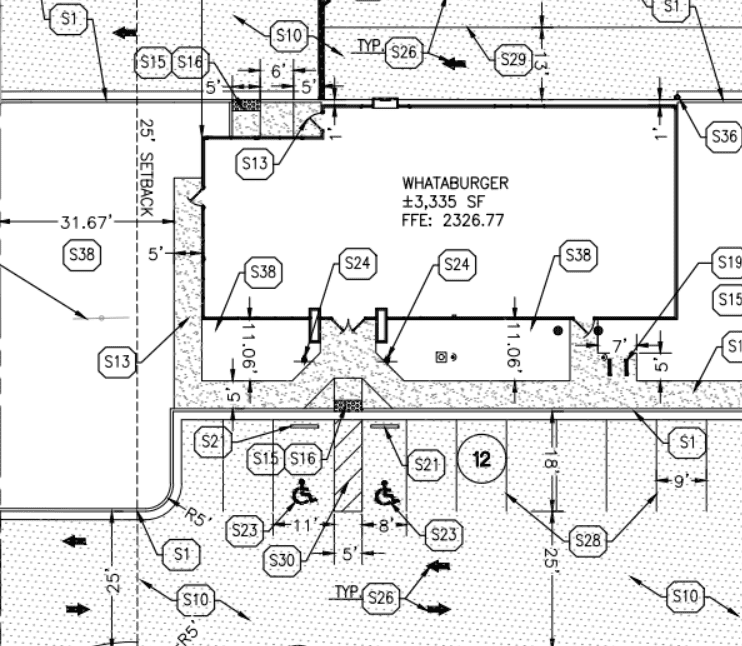
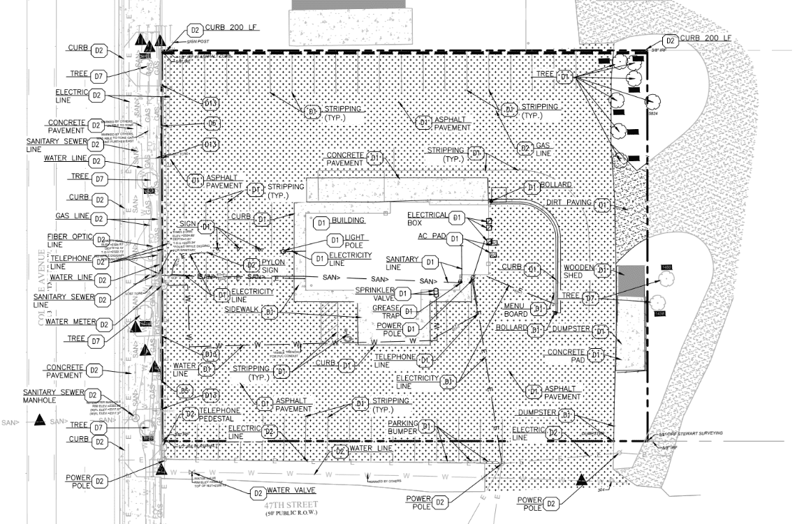
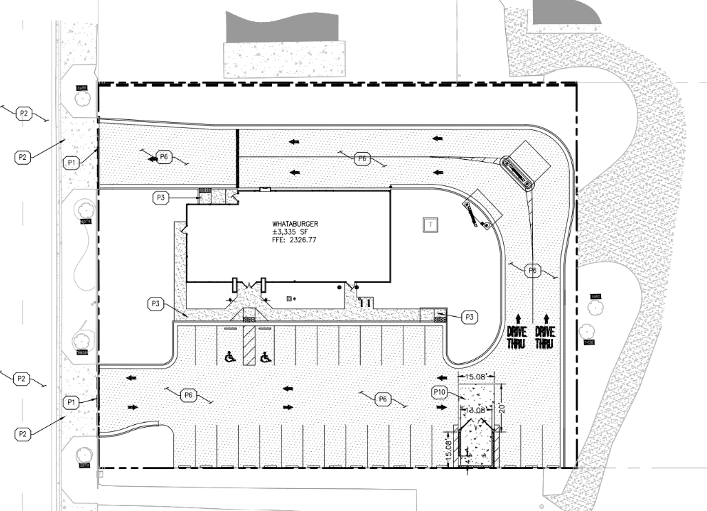
One of the flagship civil design projects that Uppteam has successfully delivered is related to its collaboration on a complex drainage and utility challenge. This project was for a national food chain’s site in Alabama. The site constituted complex grading conditions, regulatory drainage needs, and time constraints.
Here, Uppteam’s civil design team offered thoroughly coordinated CAD support to the client’s engineering team. It comprised utility alignment incorporated within the prevailing topography, stormwater management planning, and the latest base files.
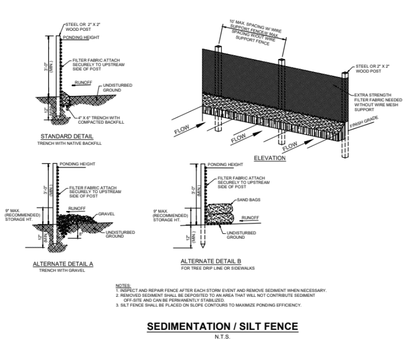
Furthermore, the expert designers of the firm created a precise Stormwater Pollution Prevention Plan (SWPPP) to maintain regulatory compliance. In this process, the firm utilized AutoCAD Civil 3D. This tool helped to design, with the utmost precision and detail, the best management initiatives, such as silt fences and sediment traps.
This effortless coordination with surveyed information and the engineering consultant allowed for smoother approvals and a speedier turnaround for construction documentation.
Another landmark civil design project for Uppteam was an urban redevelopment initiative in Texas. The firm supported this project by providing civil design coordination and utility layout services. Undoubtedly, this was a key infrastructure redesign project.
Uppteam’s experts collaborated with the relevant stakeholders to satisfy both community requirements and agency needs. The focus was on technical documentation for grading studies, utility routing, and site planning support. It facilitated efficient approval and build-ready packages for the infrastructural upgrades.
This effort signifies Uppteam’s capability in providing guidance to civil engineers on preliminary-stage redevelopment tasks, utilizing reliable design support.
There are several recurring challenges that civil engineers generally face. These involve misaligned input formats, delays resulting from unclear scope definitions, regional compliance struggles, and the complexity of coordinating across verticals.
In order to deal with these challenges, Uppteam focuses on organized onboarding, scope alignment, and team collaboration approaches. The method consists of aligning deliverables with region-specific standards, breaking down tasks into manageable parts, and providing review-ready outputs to simplify civil operations.
Being a remote civil design and survey support provider, Uppteam acknowledges the challenges of crafting accurate designs. We recognize every single challenge and see them as opportunities to improve our services. Thus, by embedding quality control and process rigor, we support civil engineers in avoiding rework and eliminating coordination friction.
Through the utilization of the remote-first model, Uppteam ensures that civil engineering teams have access to:
This tactic considerably decreases the time spent on repetitive drafting work. It facilitates engineers in concentrating on design reviews and improvements instead.
What truly makes Uppteam different from any other firm in this domain is its rigid QA workflows. We ensure:
This level of thoroughness minimizes technical RFIs and boosts constructible quality ahead of issuing documents for bidding or construction.
It is crucial to consider the fact that contemporary civil engineering requires error-free drafting and integrated design. This is, in fact, a mission where Uppteam excels. From GIS-enabled master planning and utility coordination to land surveying and grading design, we offer construction-ready civil documentation. As a result, the risk decreases and workflows accelerate.
With the help of our cloud-centric, QA-focused approach, civil engineers can receive partner-level drafting assistance tailored for the demanding AEC space in the U.S.
Do you want to elevate your upcoming infrastructure project? Partner with Uppteam right now and unravel how our error-free service offerings can empower your success.
Your One-Stop MEP Design Support Solution is Here
Hire Remote Team at an Affordable Price!