Civil
Civil Design Support Solutions for Complex Utility and Drainage Challenges for a Food Chain in Alabama
-
 Soumen
- April 22, 2025
- 12:13 pm


U.S.-based local architectural representation, ensuring communication, accountability, and delivery expectations, managed close to the client.
Explore more
Discover our architectural design excellence through a curated selection of projects.
Explore more
Take a look at how Uppteam can elevate your projects with expert engineering solutions.
Explore more
Our Structural Support Services can enhance your structural engineering projects with expert support.
Explore more
Uppteam delivers precise and reliable surveying and mapping solutions to help you make informed decisions.
Explore more
Whether you're working on residential, commercial, or industrial buildings..
Explore more
Uppteam’s Virtual Admin Support can help you with all your administrative tasks..
Explore more
Our experts work as your Second Eye Services expert.
Explore more Soumen

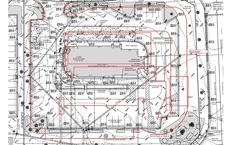
uppteam provided civil design support for a 2.47-acre commercial food chain infrastructure in Alabama. Specifically, we delivered site plans, grading and drainage design, utility coordination, and erosion control documentation for a national-level design and engineering firm. Designers Ryan Scott and Jason Pascual led the engagement, which mandated comprehensive regulatory conformance across municipal, state, and federal codes in a complex site condition.
Given the project’s complexity, Greenberg Farrow partnered with uppteam because of its proven expertise in translating intricate survey data into accurate, regulation-compliant civil designs. uppteam’s collaborative approach and deep understanding of utility and drainage challenges made it suitable to support the client’s vision.
The client required uppteam to develop detailed site plans covering layout, grading, utilities, and compliance. Simultaneously, the client wanted grading and drainage plans covering contours, elevations, and stormwater systems — including inlets, detention basins, and culverts — for proper flow and code compliance. The client also assigned measures for erosion control.
Incomplete survey data was the main constraint, making error-free topographical and boundary coordination challenging from the outset.
Compliance with US building codes, regulations, and the changing nature of municipal, state, and federal codes added complexity and could result in redesigns and project delays. Site conditions, which involved irregular topography, flood zone designations, and poor bearing soils, complicated grading and drainage planning considerably. Similarly, utility coordination required addressing conflicts with existing underground infrastructure and scheduling relocations. Environmental considerations demanded stringent compliance with regulations to manage stormwater runoff effectively.
Ensuring efficient vehicular and pedestrian circulation while adhering to ADA and traffic safety regulations added another layer of complexity. Finally, collaboration between civil, structural, and MEP teams required meticulous alignment to prevent rework and delays.
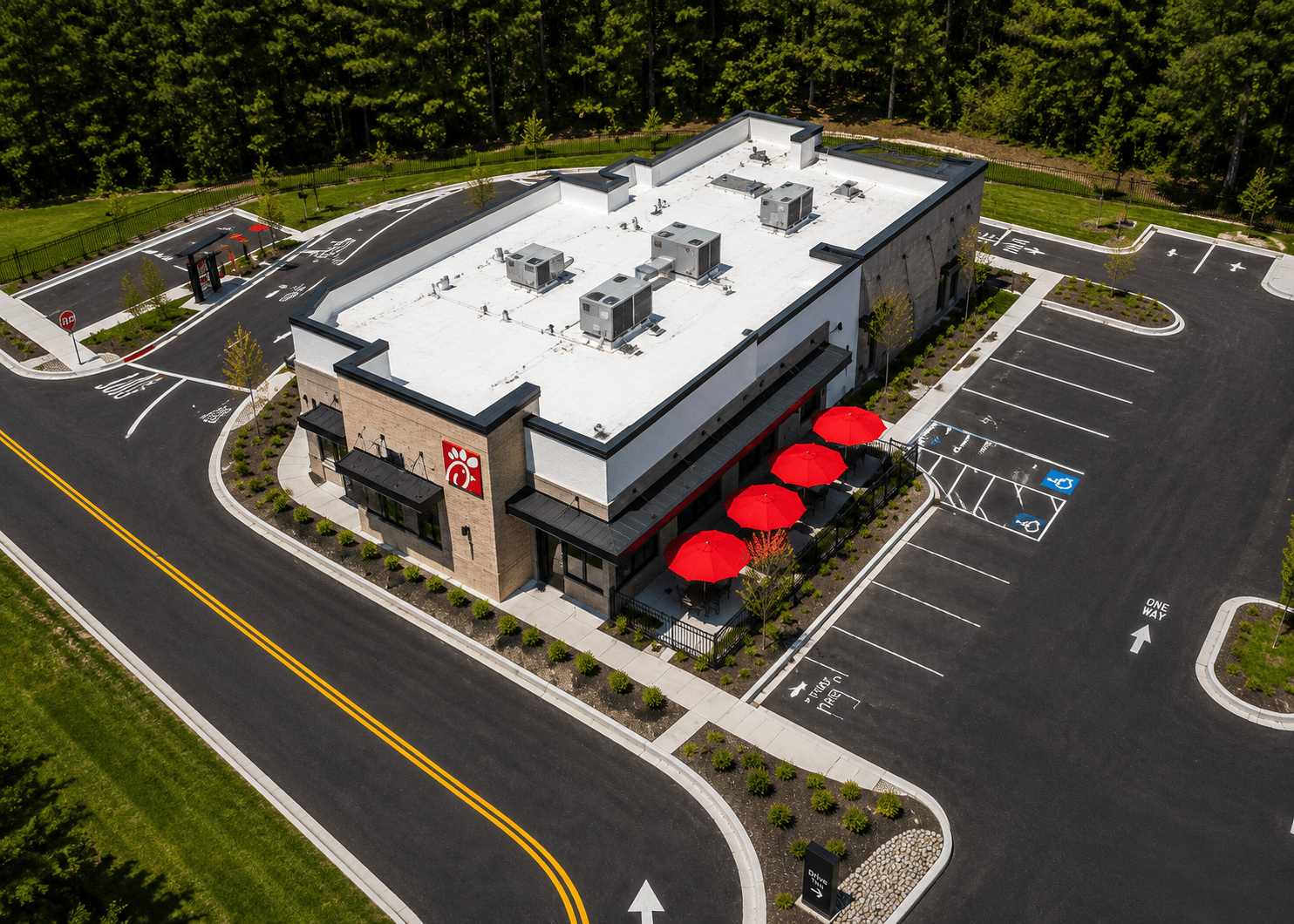
uppteam’s civil design support team performed rigorous site surveys in response to these issues. It used state-of-the-art GIS mapping tools, such as ArcGIS and QGIS, and drone analysis to provide better survey precision. At the onset, pre-application meetings with regulatory agencies allowed us to streamline permitting processes and compliance. Feasibility studies and geotechnical analysis helped guide mitigation methods, such as retaining walls and soil stabilization methods, in handling site constraints.
Our team streamlined the utility relocation, as the project required a revamped utility plan with detailed connections to essential public utility services by conducting early location surveys and coordinating directly with utility providers to schedule and prepare relocations. The designers developed a Stormwater Pollution Prevention Plan (SWPPP) to ensure regulatory compliance, using AutoCAD Civil 3D to design and detail best management practices such as silt fences and sediment traps.
Ongoing monitoring during construction also enabled regulatory compliance. We conducted traffic impact studies to maximize site access and circulation. The team included adequate turning radii, signage, and pedestrian paths in the design to facilitate accessibility and safety. Regular interdisciplinary coordination meetings and the application of Building Information Modeling (BIM) software facilitated efficient collaboration and conflict resolution between teams.
Since the client wanted to understand the restaurant’s feasibility, they asked us to create static and dynamic 3D renderings. As soon as the client approved the iterations, we started working on 3D models to explain the operational practicality.
The combined application of GIS-precision surveying, simultaneous regulatory coordination, BIM-embedded interdisciplinary collaboration, and proactive utility relocation planning delivered a code-conforming, construction-ready civil design set. We completed the task promptly and without any redesign cycles.